Clinch River Railroad
Clinch River Railroad - traffic network in Google My Maps
- Details
- Kategorie: Clinch River Railroad
- Zuletzt aktualisiert: Samstag, 05. November 2016 17:33
- Geschrieben von Michael Homberg
Clinch River Railroad:
traffic network in Google My Maps
Google My Maps allowes to place the trackage into the map - and to share it
What is "Google My Maps"?
I got the information I needed to set upp this map after I put these words into Google.
"Clinch River Railroad" (= CRRR) is a freelanced model railroad, invented and designed by Phil Brooks. It is modeled to look and work like the prototype railroads in the Appalachian coal fields in the '50s.
Therefore, the place was set. A real place, and the Railroad was laid into that place.
The real world is mapped, and can be seen in Google Maps.
When I discovered that Google My Maps makes it possible to add individual information, to store it, and to share it to others, I tried to map the trackage of Clinch River Railroad.
What are the starting points for this map?
- the publications about CRRR by Phil brooks
- discussions with Phil
- Google My Maps, for the Maps
- the topography
- 1955 as the status of CRRR, given by Phil
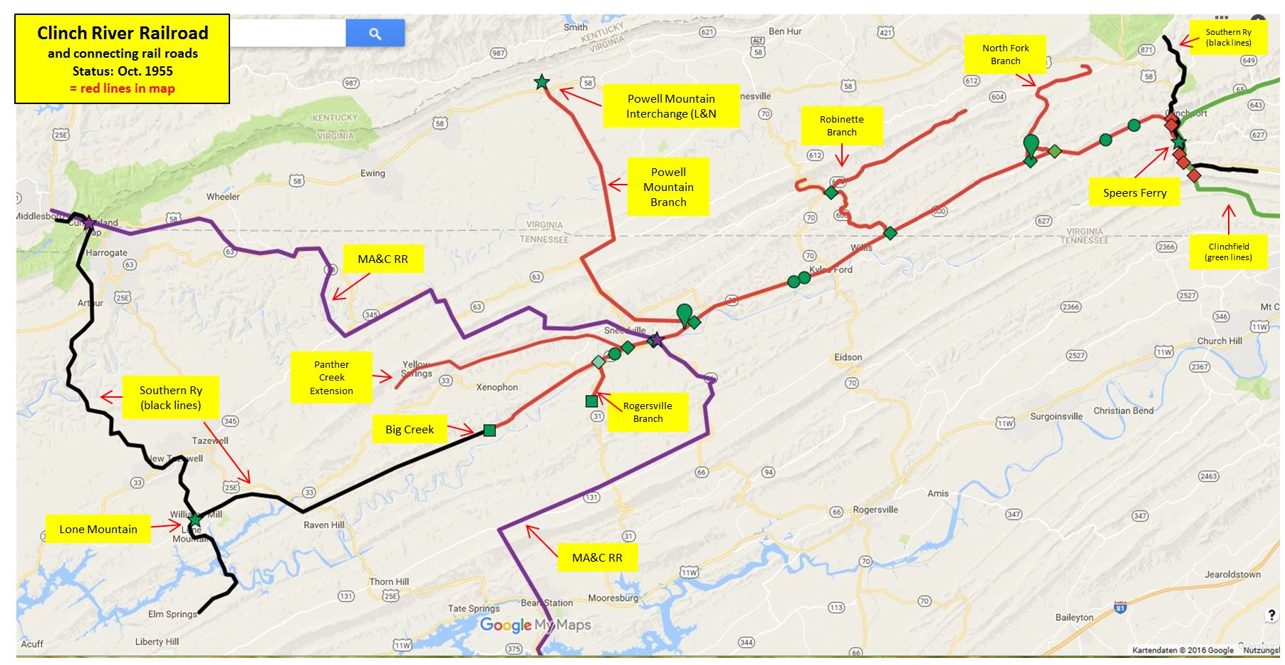
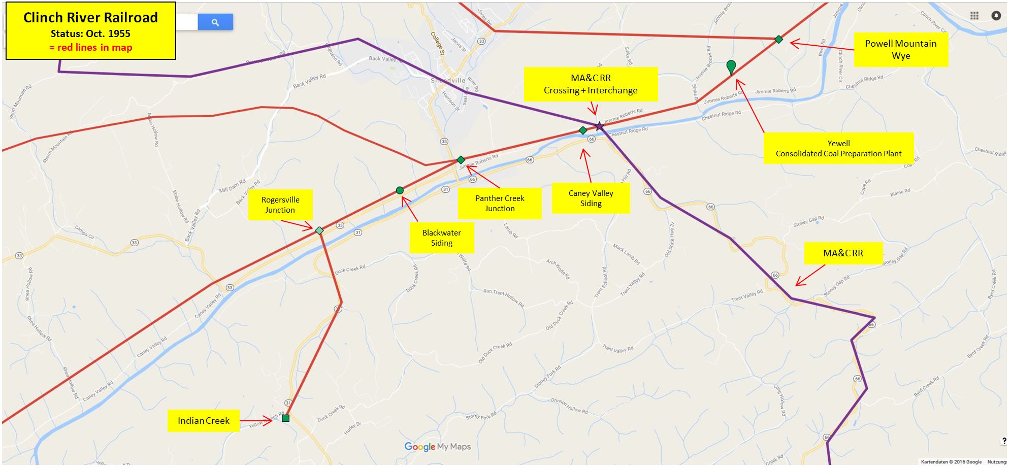
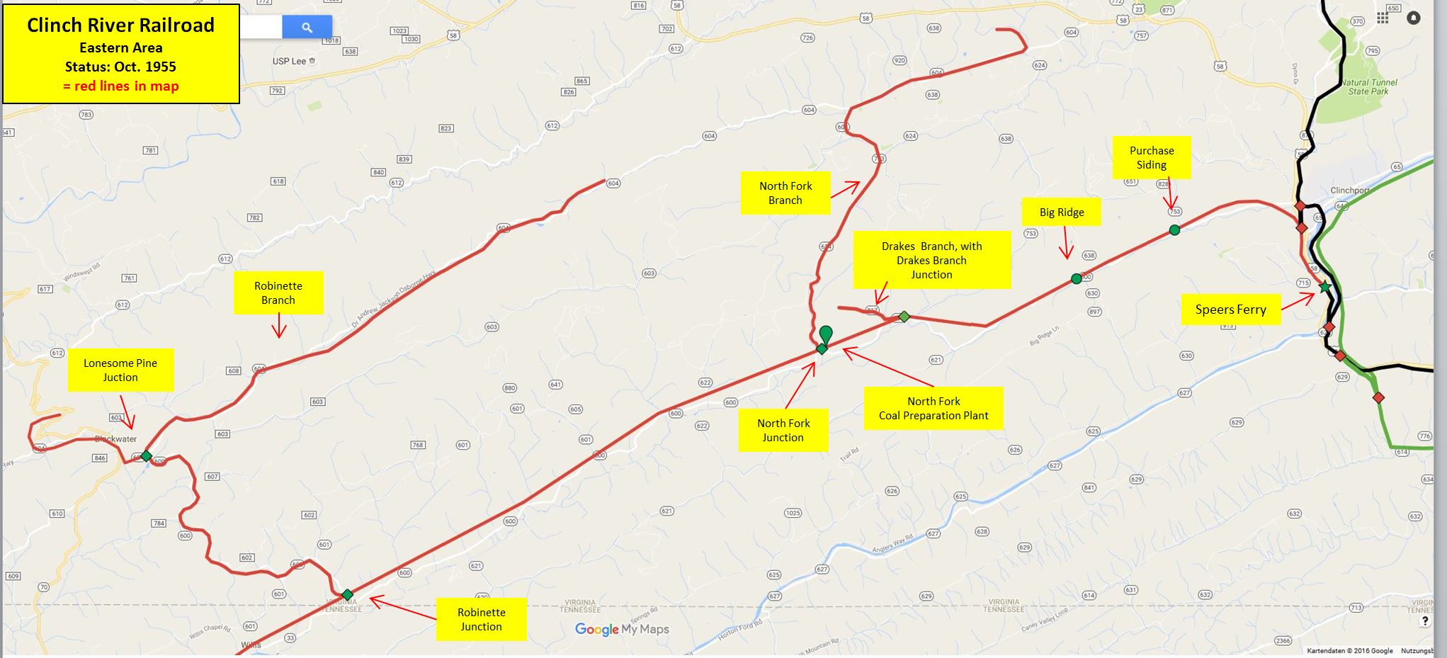
Here is my guess of where the tracks of CRRR would have been in 1955:
This is what it looks like in Google My Maps. Klick here, or on the picture, to get a larger image
For lager images, please click on those.
Clinch River Railroad trackage (in red), and connecting rail roads
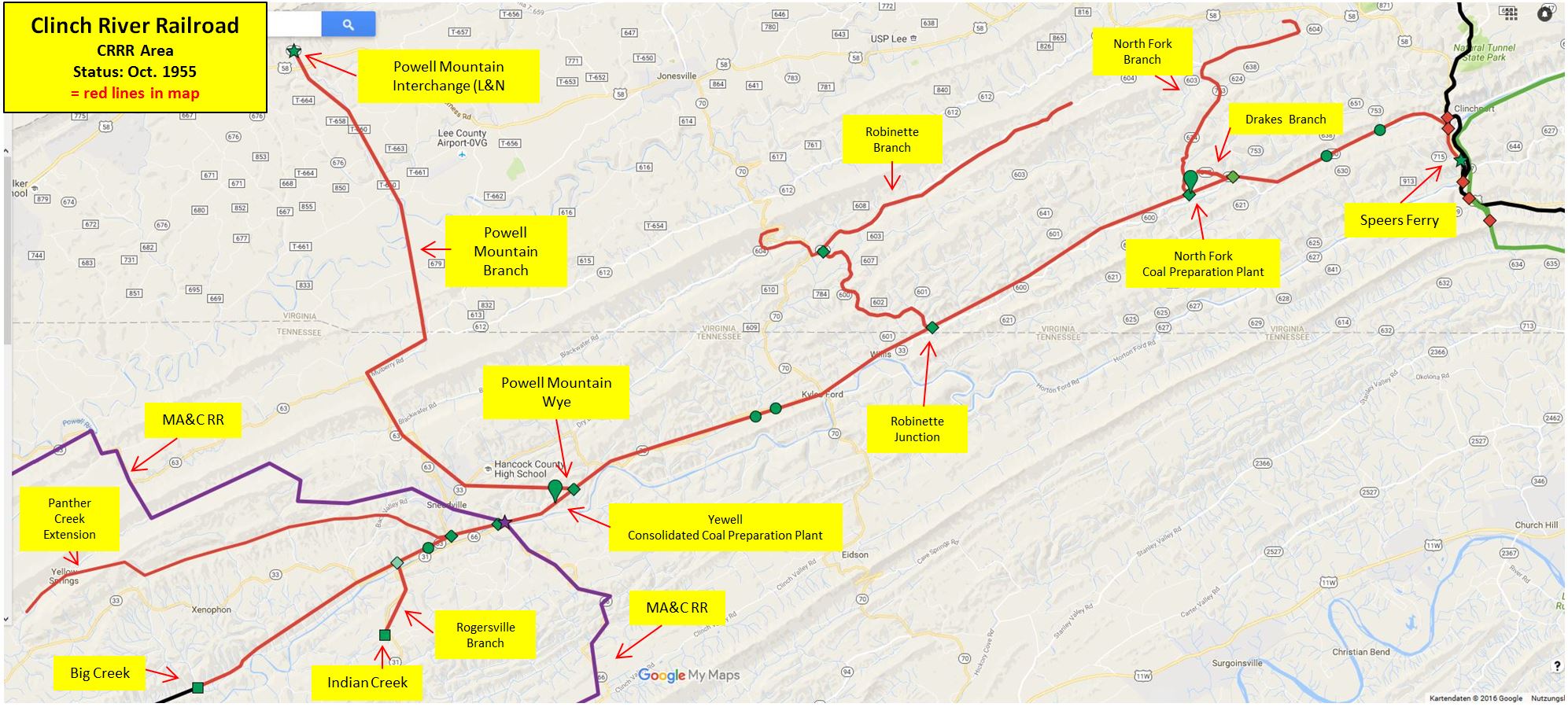
CRRR trackage, overview
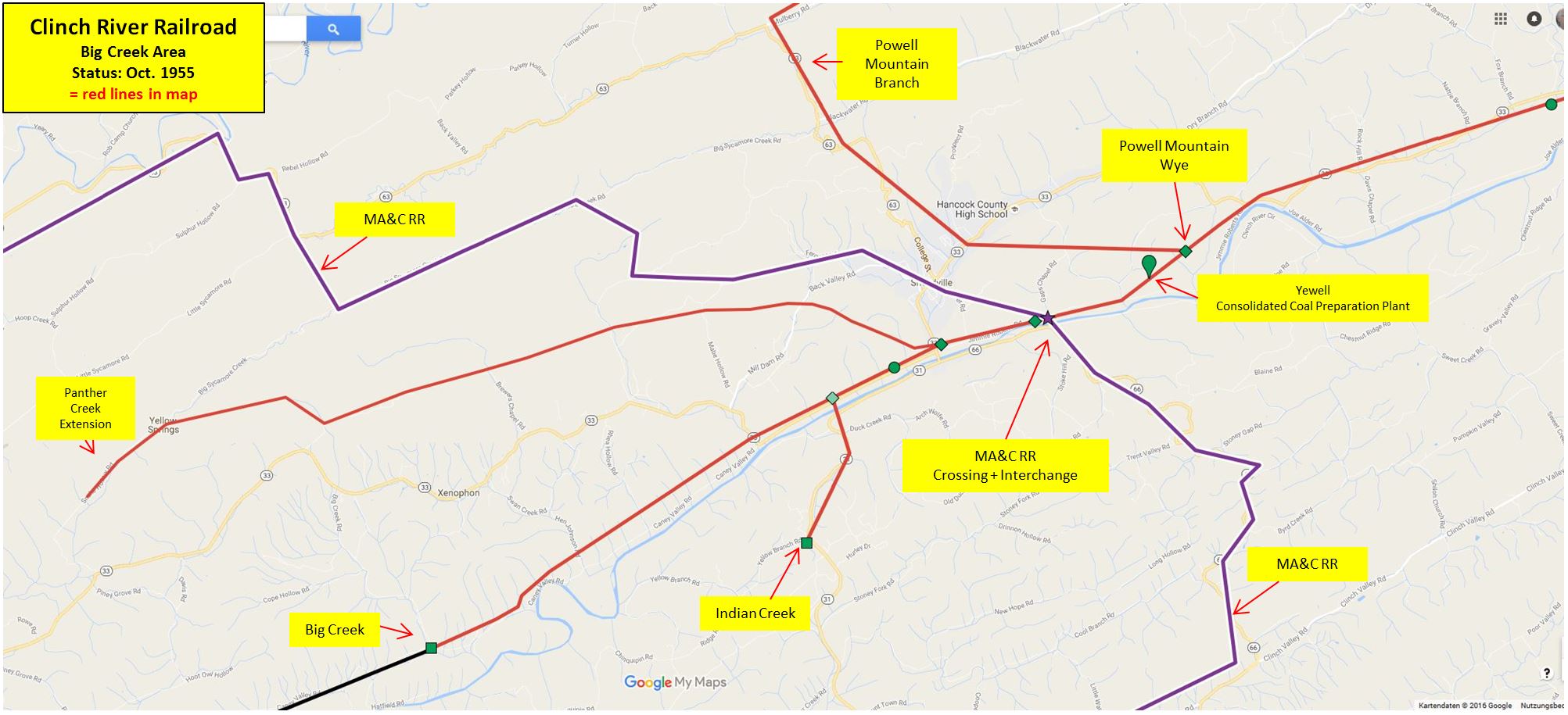
CRRR, Big Creek Area
CRRR trackage around Sneedville (TN), town above Panther Creec Junction
CRRR trackage overview, eastern part
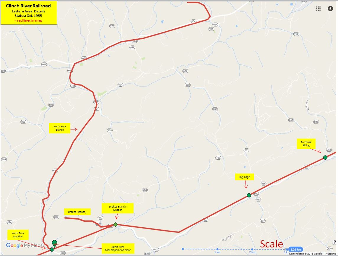
Detail of map, with scale (in Kilometer)
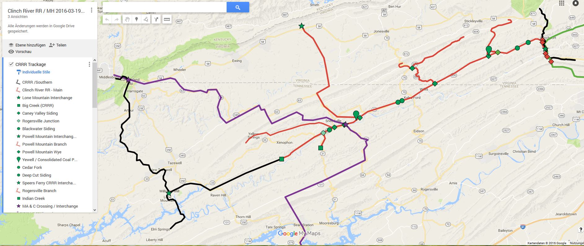
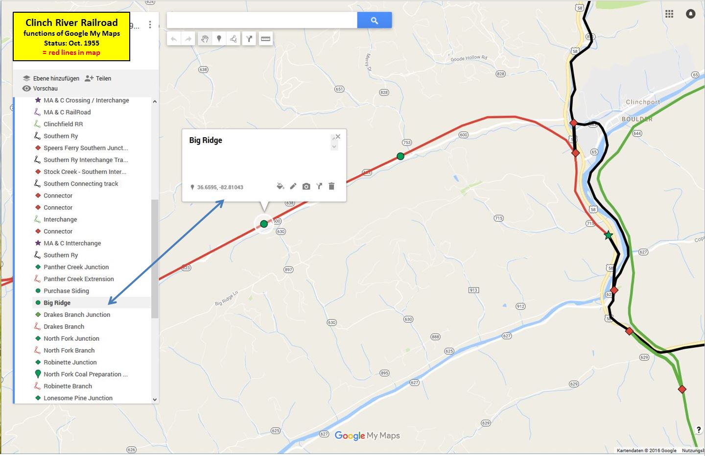
This is what Google My Maps looks like:
- blue arrow: if one clocks on one symbol ("at Big Ridge" in the picture, a description field pops up, giving information of the name og the location, and the coordinates.
- to go to "Big Ridge", one can click on "Big Ridge" in the column on the left, too
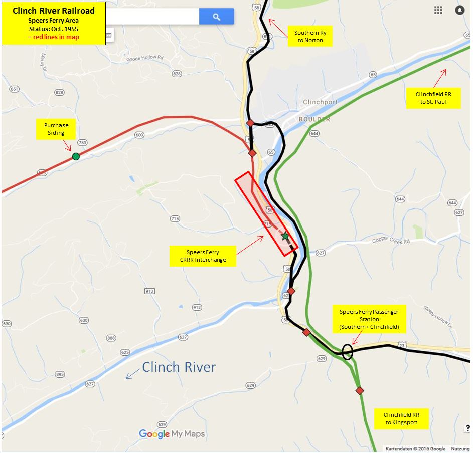
CRRR, Speers Ferry Area, with connecting rail roads Southern Ry (black) and Clinchfield RR (green)
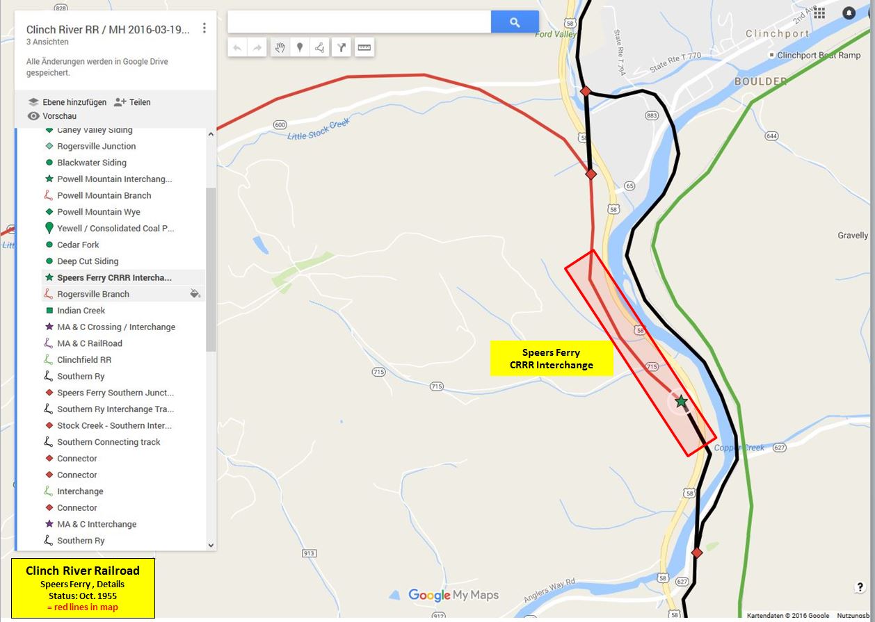
Details of Speers Ferry CRRR Interchange


